 Practical SOTA - navigation tools
In the first step install OSMAND application (http://osmand.net )to your Android/iPhone smartphone and download maps for your region of interest so that they can be used offline.
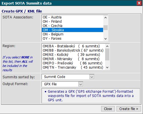
Next, we need to export summit data of given region from SOTAMAPS.ORG (https://www.sotamaps.org).
On SOTAMAPS.ORG find export button, choose the country (SOTA association) and region - I usually don't select any - all regions will be exported. It is important to choose Output format as GPX, this can be easily imported to OSMAND. Select "Create file" and save the GPX file.
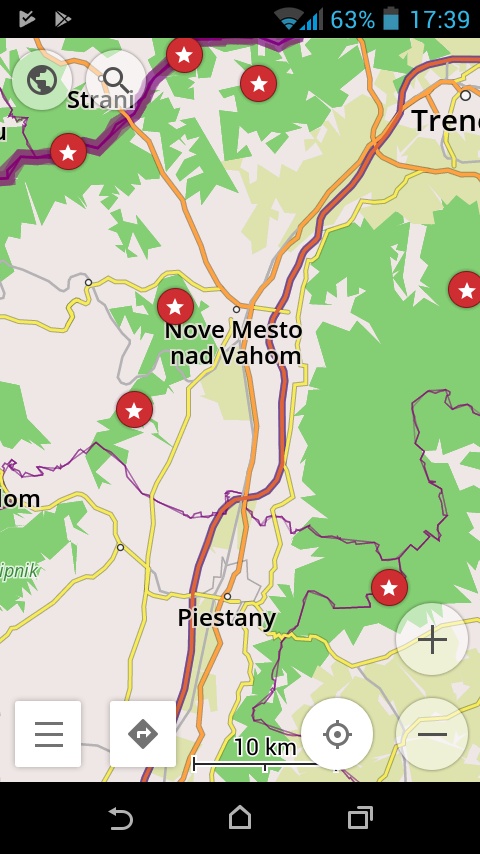
You can now import the GPX file to OSMAND, where you have option to import it as Favorites or as GPX-Tracks (Trips). I usually send it to my own email address from my PC, open the mail application in smartphone, tap on the attached GPX and the file can be imported (having two options mentioned above). I always choose the second option as the tracks/trips can be selectively displayed based on my current needs. I have also imported WFF (Flora-fauna) waypoints this way, this is much larger database so you see the reason.
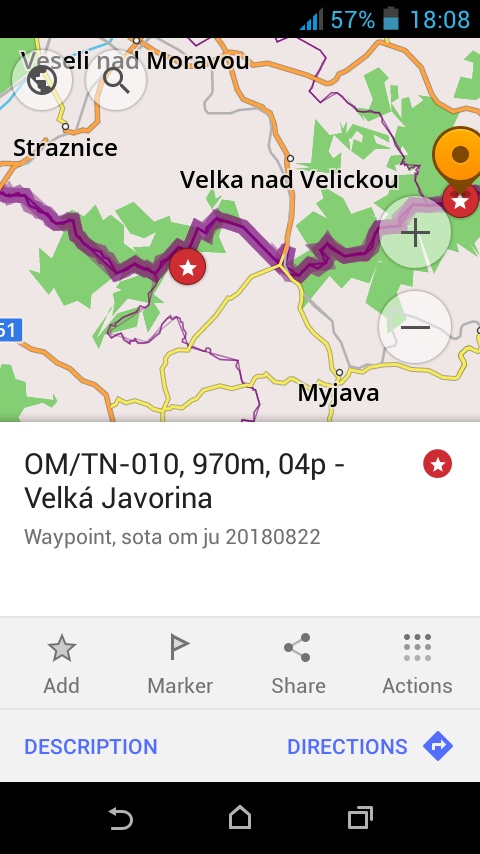
Lastly, I have created simple PERL script which converts original GPX to new one with extended SOTA reference names. By taping on the summit marker there is direct information about summit reference, summit height, SOTA points and finally the summit name, see the picture below on right side. So I'm importing this modified GPX to OSMAND. The PERL script sota_gpx_conv.pl can be downloaded from my #programming pages.
Run the script in command line, example:
perl.exe sota_gpx_conv.pl gpx_data.gpx > new_gpx_data.gpx